Visual Inertial Odometry (VIO) Based UAV for Agricultural Usage
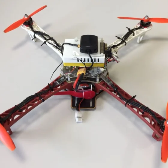
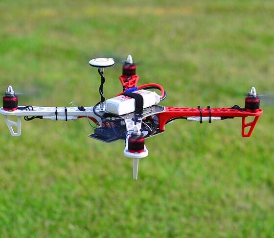
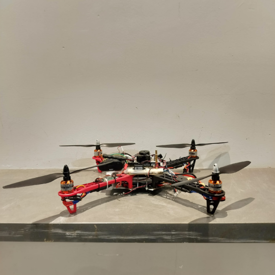
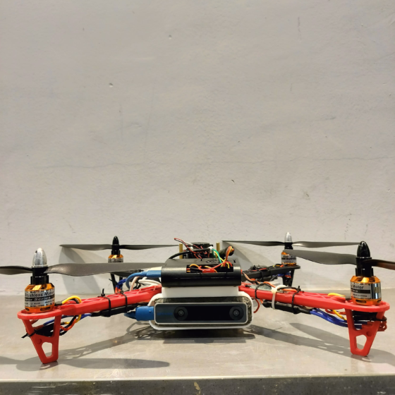
The S450 Quadcoptor is a robust and reliable UAV equipped with Intel Realsense technology for visual-inertial odometry (VIO). This advanced system allows for precise indoor and outdoor navigation, making the S450 ideal for data collection, inspection tasks, and various commercial applications.
With its versatility, reliability, and advanced capabilities, the S450 quadcopter stands as a professional-grade solution for aerial exploration, data acquisition, and mission-critical operations across a spectrum of industries.
FEATURES
Intel Realsense VIO Technology
Achieve superior stability and positioning with real-time environment mapping and obstacle avoidance using Intel Realsense technology.
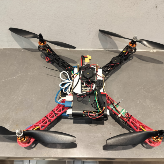
Modular Payload Bay
The S450’s modular design allows for customization with various payloads, including high-resolution cameras, LiDAR sensors, or specialized equipment for specific tasks.
User-Friendly Control System
The S450 is equipped with a user-friendly control system, making it accessible to pilots with varying experience levels.
INDUSTRIES
Data Collection & Inspection
Achieve superior stability and positioning with real-time environment mapping and obstacle avoidance using Intel Realsense technology.
Precision Agriculture
Leverage the S450 for crop health assessment, field data collection, and optimized agricultural practices.
Security & Surveillance
Utilize the S450 for perimeter patrol, security monitoring, or surveillance tasks in large outdoor areas.
TECH SPECS
Autonomous Quadcopters Technical Specifications
Model
1061 x 854 x 1224 mm
Configuration
Multi-copter with Vertical Take-Off and Landing
Flight mode
Fully autonomous and no manual flying needed for mapping the required area.
Endurance
>40 Minutes
Max Range
2 km in radio Line of Sight
Max Flight altitude
400 Ft AGL (as per DGCA Norms)
Weight
3.6 Kg
Flying Speed
5m/sec
Area coverage
Up to 100 hectares in single flight with resolution of 3.5 cm or better.
Launch and recovery
Vertical take-off and land from/in 5m X 5m patch of land.
Wind resistance
Operates in wind speed up to 15m/s
Operating temperature range
0 to +50 degree Celsius.
Portability
The drone is portable enough to be carried by 1 person or in a car.